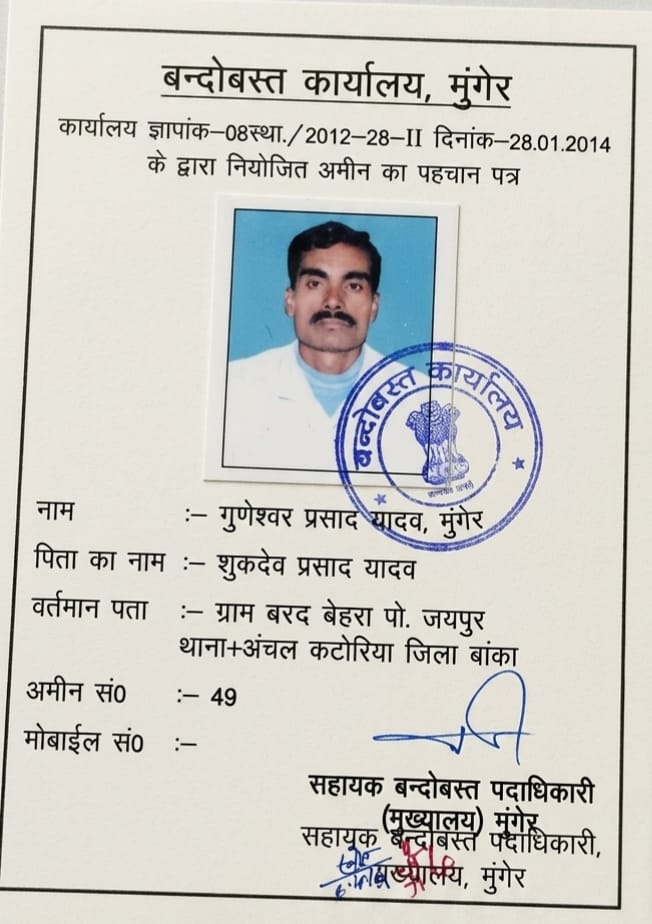
सरकारी प्रमाण-पत्र प्राप्त वरीय बन्दोबस्त अमीन
बांका, मुंगेर एवं संताल परगना (देवघर) राजस्व क्षेत्र में 1,200+ से अधिक विवाद-मुक्त स्थल नापी व पंचनामा का अनुभव
Serving families, property buyers, and ancestral shareholders across Bihar and Jharkhand with uncompromising integrity. Shri Guneshwar Prasad Yadav holds government certification in land revenue settlement and is recognized across the regional administration for rigorous Cadastral Mouza sheet alignment (16"=1 mile), Gunter chain boundary demarcation, and neutral resolution of boundary conflicts.
How we conduct every single measurement, boundary pegging, and dispute consultation:
We report what is physically on the ground and recorded in the 16-inch Cadastral map—never what brokers or interested parties wish to hear.
Careful, unhurried triangulated measurement from authentic village Seh-Hadda (three-corner) benchmark stones using Gunter chains and laser meters.
15+ years reading historical British Cadastral (CS), Revisional (RS), and Chakbandi sheets alongside digitized Panji-II and Jamabandi ledgers.
Every field survey culminates in an authentic Nazri Naksha and Panch Panchanama, admissible as empirical evidence in revenue and executive courts.
Dedicated to preventing fraud, illegal encroachment, and ensuring equitable road access (Right of Way) during ancestral family partitions.
नापी की शुद्धता केवल कागजों से नहीं, बल्कि अधिकृत उपकरणों व राजस्व सीमाना पत्थरों से तय होती है:
16" = 1 मील राजस्व नक्शे पर 1-1 कड़ी (6.6 इंच) को शुद्धता से मापने का मूल पीतल व हाथीदांत पैमाना।
66 फीट / 100 कड़ियों की प्रमाणित लोहे की मानक जरीब—खेतों व भूखंडों के मानक राजस्व मापन का आधार।
चुंबकीय उत्तर दिशा (Magnetic North) एवं सीमा रेखाओं के सटीक कोणीय बेयरिंग मिलान हेतु।
सड़क की चौड़ाई, मेड़बंदी और निर्माण स्थलों की मिलीमीटर-सटीक आधुनिक डिजिटल लेज़र दूरी पैमाइश।
Technology alone cannot resolve property doubts without verified ground truth. LandAmin starts with real people who know the land:
Decades of on-ground surveying, chain measurements, Mouza triangulation, and local settlement offices across Banka, Munger, and Santhal Pargana.
Standardized 18 land services, pre-purchase 12-point due diligence, certified document home delivery, and digital property risk auditing.
The next-generation spatial property intelligence layer combining AI reasoning, geospatial maps, and verified land records across India.
Speak directly with certified Senior Settlement Amin Shri Guneshwar Prasad Yadav for professional plot surveys, pre-purchase verification, or family boundary partition.